November is starting out quite hot around the Ohio Valley right after an end to the warmest October on record for Louisville, Ky! The 116 year old record was official broken as the average temperature for the whole month reached 66.2 degrees; 6.7 degrees above normal. More records are in jeopardy this month.
Two records were broken for the first of November. The all time record high for the month of November of 84 degrees set back in 1958 and the record high for November 1st of 83 set back in 1987 were both broke today. The temp at Louisville International Airport rose to 85 degrees! The heat will continue into tomorrow where another record could be broken.
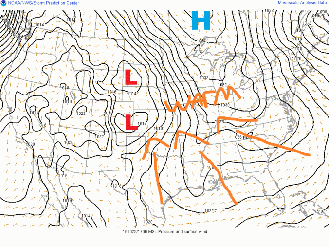
Here is the set up responsible for the record heat around the region. The map below from the SPC shows a large ridge of high pressure over the south eastern United States. Record warm temps and sunny skies can be found under this ridge.

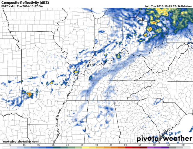
This ridge will stick around for another day before the storm system in the west approaches bringing cooler weather and the chance for storms. After another record warm afternoon on Wednesday in the low 80s, clouds will begin to increase Wednesday evening. By early Thursday morning s front will push through the region bringing a chance for rain and a few rumbles of thunder. The NAM4k below shows a forecast of the radar early Thursday morning showing scattered rain showers throughout the region.
After the front pushes through nice weather will return from Friday through the middle of next week. Temps will be a lot cooler to start out the weekend with highs struggling to reach 60 Friday. By early next week temps will be back into the lower 70s. Overall, not a bad weekend in the forecast!
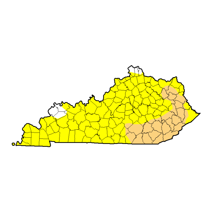
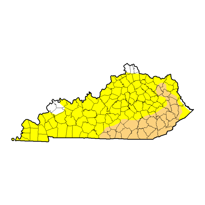
Unfortunately the Ohio Valley really does need more rain. Drought conditions continue to be widespread across Kentucky and will continue to get worse if a big rain event doesn’t happen soon. As of now no big rain events are in the forecast. The map below from the US Drought Monitor shows most of the state of Kentucky in then abnormally dry category while much of South and Eastern Kentucky is in a severe drought.
Forecast:
Wednesday: Am sun, clouds increasing in the afternoon. Lows in the mid to upper 50s. Highs nearing record levels in the low 80s.
Thursday: Am showers, pm partly to mostly cloudy. Lows in the upper 50s. Highs in the mid 60s to near 70.
Friday: Mostly sunny skies. Lows in the upper 30s to low 40ws. Patchy frost possible in cool spots. Highs in the upper 50s to low 60s.
Saturday: Sunny skies. Lows in the mid 30s to near 40. Patchy frost possible. Highs in the low 60s.
Sunday: Sunny skies. Lows in the lower 40s. Highs in the mid to upper 60s.
Monday: Sunny skies. Lows in the low to mid 40s. Highs in the mid 60s to near 70.