It is safe to say that 2016 has been a warm one! In fact, three months this year already have made it into the record books. March 2016 was the 8th warmest March on record since records began in Louisville in the 1870s. This August was the 9th hottest August on record and September was the 6th hottest on record. By the look of things, October 2016 could fall into the top 3 warmest Octobers on record for the Ohio Valley. The forecast over the next week and into Halloween will feature above average temps and mostly dry conditions. We’ll break the week’s forecast down below.
Currents
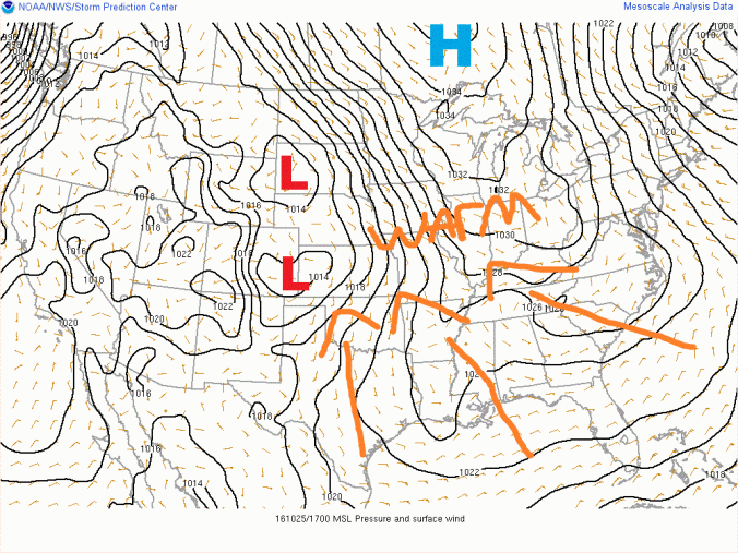
Today a high pressure system way to the north and a low pressure system off to the west is putting the Ohio Valley in a great spot for some gorgeous fall weather over the next couple days. This morning started out chilly with mid to upper 30’s in many locations. Temperatures have since rebounded into the low to mid 60s in the east and upper 60s to near 70 farther west towards Bowling Green, Ky. The map below from the SPC shows the current set up.
Tomorrow
By tomorrow, the entire region will be in a southerly flow ahead of the low pressure system that will skirt by to our north early Thursday morning. Wednesday will feel more like summer than mid fall. Temps and humidity will be on the rise. Highs everywhere should top 70. Southern and Western Kentucky may even flirt with 80!
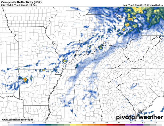
Late Wednesday night into early Thursday morning, that system to our north will push a weakening front through the region. Scattered showers and maybe a rumble of thunder or two will move through with the front. Southern Indiana and Northern Kentucky stand the best chance of seeing any activity. Farther south showers and storms will be more isolated. The simulated radar below from the NAM4K model shows this well.
Unfortunately, the Ohio Valley does need the rain. The current map below from the US Drought Monitor shows a drought beginning to set in across the entire state of Kentucky. In fact, as of 10/18, 21% of the state is now in a severe drought (light brown) compared to only 6% on 10/11.
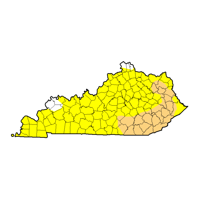
That map is a little scary,especially since there does not seem to be much relief in sight, even in the long term.
Speaking of scary, let’s talk about the Halloween forecast for everyone planning on dressing up and going trick or treating. As of now Halloween looks to be very nice with highs in the upper 60s and lower 70’s around the region with dry conditions! Keep in mind this forecast is a week out and could change. But for now, the weather looks perfect!
Here are some past Halloween weather facts for other weather nerds out there provided by the NWS Louisville.
Snowiest: Trace (flurries) in 1993, 1954, and 1930
Deepest Snow Cover: Trace in 1993 Wettest: 1.68” in 1941
Warmest Temperature: 84 in 1950
Warmest Daily Average Temperature: 71.5 in 1900
Coldest Temperature: 26 in 1887
Coldest Daily Average Temperature: 34.5 in 1925
Forecast:
Tuesday: Mostly sunny skies. Highs in the mid 60’s in the east to near 70 in the west.
Wednesday: Mostly sunny skies. Clouds increasing later in the day. Lows in the low to mid 40s. Highs in the low to mid 70’s. Near 80 across the south.
Thursday: Early morning showers, then drying out in the afternoon. Lows in the mid to upper 50s. Highs in the mid 60s.
Friday: Sunny skies. Lows in the low to mid 40s. Highs in the mid to upper 60s.
Saturday: Partly Cloudy skies. Scattered shower possible. Lows in the low to mid 50s. Highs in the low to mid 70s.
Sunday: Mostly sunny skies. Lows in the upper 40s to low 50s. Highs in the upper 60s to lower 70s.
Halloween: Mostly sunny skies. Lows in the mid to upper 40s. Highs in the mid to upper 60s to near 70.

Reblogged this on Cards Eye View.
LikeLike